Saturday, 30 September 2017

Durmitor National Park

We have spent the last few weeks on the Montenegrin Riviera. But today we will say goodbye to sandy beaches and emerald sea.


We will be heading to one of the National Parks of Montenegro. To reach it, we need to pass through mountains. Since Monte-Negro means literally "Black Mountain", I would expect them to be black. But to my surprise, they were green.


Then we need to drive on the shore of Lake Skadar. They say that if you are lucky, you can meet there pelicans.


The Skadar Lake is alimented by river Morača. The river is narrow and shallow.


But what makes it interesting is that it runs in a canyon, which means that it is surrounded on both sides by high hills. And when I say high, I mean it.


In fact, the road is winding together with the river, glued to the steep slope. You will not be surprised to hear that it is considered to be a very dangerous road.


Finally, we reach our destination. The Durmitor National Park.


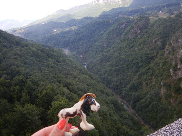
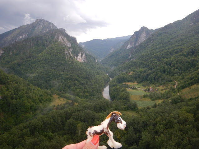
Its biggest attraction is the canyon of river Tara, the deepest in Europe and second deepest in the world. Just imagine, that this small, shy river has shaped such big mountains.


As we stop to take a break, we can show our admiration to the best alpinist of the region, Dušan Bulatović Džambas.


Time to move again, the biggest attraction is still ahead of us.


I am sure that you are curious to know what this biggest attraction is. Well, it is a bridge.


Does not sound impressive? And if I say this used to be the tallest bridge in Europe? Đurđevića Tara Bridge links to sides of the canyon of the Tara river and is for sure an amazing piece of civil engineering.


No matter if you look on the left ...


... or on the right, it is almost hard to notice the river itself. I even start to wonder if it was really needed to build an entire bridge over it.


It is by looking down from the bridge that one realises that it is maybe not that small. And that building a lower bridge was not real an option. At least until humans invent lorries that can go up the hill. Horizontally.


Obviously, humans have invented a smarter way to move over Tara river. They call it a zip line. No one will ever convince me that human beings are fully sane. No horse would ever try to ride on a thin line over a canyon.


I hope that now you understand why Durmitor National Park has joined the UNESCO World Heritage List. It is indeed one of a kind.


Saturday, 23 September 2017

Fortress of St John in Kotor

If you thought that we are fully done with Kotor and its bay then I have a surprise for you. Here comes the third time lucky post from the region. And we have a very good reason for devoting a separate post to the Fortress of Saint John in Kotor, since it is part of yet another UNESCO World Heritage Site, inscribed on the list in 2017 only - the Venetian Works of Defence


As you have seen in the last post, the Kotor fortress is located high up the mountain. So say goodbye to the sea level ...


 ... and prepare to climb up 1,350 steps!


As we conquer the steps, the magnificent panorama opens to us. You can admire both the city of Kotor, with its many churches ...


... and the entry to the Kotor Bay. Unfortunately some trees still hinder the full picture.


Somewhere in the middle of our way to the upper fortress you will find the church of Our Lady of Health, where the troops could attend their Sunday service.


It is only from the upper side of the walls that we can fully acknowledge the amazing construction of the city walls of Kotor, with the very unique triangular harbour.


And it is also only from the top of the hill that we can truely appreciate the entrance to the Kotor Bay. No trees this time.


And here it comes, the Fortress of Saint John which once upon the time protected the sea routes and ports of Venice in the Adriatic Sea.


Today Venice is just a small town in Italy. So the lion of Saint Marc does not roar anymore in Kotor. The Montenegrin eagle spreads his wings wide on top of the fortress.

Source: https://meanderbug.com/

Saturday, 16 September 2017

Kotor city

In the last post we discovered the amazing Bay of Kotor. Those of you who have looked at the link to the UNESCO website recognised, that the site covers the whole region, including the city of Kotor. So it is time to discover the place that gave the bay its name. Let's leave our boat in the marina and move along.


The Old Town of Kotor is guarded by a solid wall.


The location of Kotor is very safe, with the sea in front and a mountain behind. Very feng shui.


Though to be honest, the pragmatic architects of Kotor made sure that the wall climbs up the hill as well.


I propose that we enter by one of the gates on the right. There are two reasons why I chose it. First it has a very cute guardian with long red hair.


And second, amoung the flags you can quickly spot the UNESCO emblem.


As we pass the moat, you can notice the barred window that allowed defenders to take a close look at whoever would like to approach the town from the sea.


If you want to find out more about the maritime heritage of Kotor, I strongly encourage you to visit the Maritime Museum.


Kotor was a Venetian city and then it belonged to the Empire of Austria and Hungary. As we walk through it, you can feel a certain mixture of styles. The palace of the Prima family was build in the seventeenth century and looks quite Italian.


The Town Hall which used to be the Austrohungarian general staff house was built in the nineteenth century.


Next to the Town Hall you will notice the cathedral of Kotor, devoted to Saint Tryphon (do not worry, I have never heard of him before either). It was built in the twelfth century, when Byzantium was still powerful.


Inside, the cathedral is pretty modest.


Look up to those little windows. They bring light but they do not go to the external world, they link the church to an internal gallery that runs on the upper floor and which houses the museum of the cathedral.


You can admire there some religious artefacts as well as paintings.


To reach the gallery you need to use the staircase, made entirely from Italian marble.


On the picture showing the facade of the cathedral you might have noticed that between the towers there is a balcony. It looks a lot like the one in the cathedral of Saint Marc in Venice which we have visited last year. And like with the other, you can admire there the market square from bird eye perspective.


As you may have guessed, the cathedral is not the only church in town. Because of the mixed cultural background of the inhabitants, there has to be also an orthodox church. Or better two. The large Saint Nicolas church ...


... and just next to it a smaller one, dedicated to Saint Luke.


The streets of Kotor are narrow and shadowy so it is not easy to take good pictures. So I strongly encourage you to take a look at one of the many panoramic pictures available on a special website. Alternatively, we may also try to look at the city from the top by climbing up to the Fortress of Saint John. Ready? Then take a short break and we will climb up next week.


Saturday, 9 September 2017

Bay of Kotor

As we move along the shores of Montenegro, we have to come to the Bay of Kotor, one of the most amazing places in the Balkans.
 

It looks like a fjord, but fjords are created by glacier erosion and can only be found in Northern Europe and America. And we are in the Balkans. Sunny and warm Balkans. Still, just take a look at this view.


The sea enters sharply in between the mountains, being the Dinaric Alps. But what you actually see is the remaining of an old river that does not exist since ages. It used to flow from the mountains to the sea. Now all that is left is the bay, spotted with small villages.


As we go down, you will immediately recognise that for sure we are not in Norway or Alaska.


This nice city is called Perast. It is an important point on the shoreline because of its ferry service.


The ferry can take you to the islands of Our Lady of the Rocks and St. George.
 

The Island Our Lady of the Rocks (Gospa od Škrpjela) was made as an artificial island from more than a hundred shipwrecks filled with stones. According to a legend, two seamen from Perast have found an icon of the Holy Mother of God with the Christ on a sea rock in 1452 and they vowed to build a church for that icon. They had no land to build it on, so they start building the isle first. Finally, the church was built in 1630. As the island had to be maintained, the seaman continued to bring the stones and rocks, and that tradition is alive even today. This event is called Fašinada and it is held on every 22nd of July. It’s now accompanied by a two-day yachting regatta, the Fašinada Cup, with participants racing to Tivat and back.


The other, darker island, is the Island of St George (Sveti Đorđe). That island is natural and it used to be a cemetery for all nobility from Perast. Now there is an Orthodox Church. As you may imagine, both churches are hugely popular as wedding destinations for catholic and orthodox couples respectively. 


The unique and universal value of the Kotor Bay was recognised by UNESCO who inscribed it on the World Heritage List already in 1979. I hope that after this post  you will not be surprised.

(C) IP Studio Strugar (postcard)